a 12.3 mile course designed to go over 7 of cincinnati’s toughest hills. it is not a race, it isn’t timed–it is for participation, and the goal is to run up each hill without walking, and to provide commrodery with other runners. this event is 28 years…running! (haha). it is a challenging course.
When: December 4th
where: Cincy
Time: report no later than 9:30 am, event starts promplty at 10am.
would anyone like to do this with me? (groups and pairs are encouraged, i won’t do it unless someone else can go with me)
By all means Cincinnati does not have any mountains like you guys have out there in California, Colorado etc… The terrian is very similar to San Francisco, non stop rolling, STEEP hills. Running there an be a real challenge. You would be hard pressed to find many tougher marathons than the Flying Pig in Cincinnati.
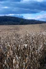
One time I was in Fresno for business, I decided to take a trip up to Sequoia at about 3 in the afternoon or so. It was summer so it stayed light until about 9pm so I did get to see some sights and trees and so on. Well instead of turning around in the park I decided to keep going as the map looked like it circled around back to Fresno for a nice scenic drive. That was a terrible decision. Somehow I got lost in the miles and miles of Orange groves, everything looked the same in every direction. I saw a few “farms” with more cows per square foot than I ever thought was possible. I stopped at one of them after the road I thought was leading me Fresno turned to dirt. Somehow they gave me directions back to Fresno, and I arrived at my hotel at 4:30am. I have never been so scared in my life, I really was lost out there, and running out of gas. Seeing the picture of those cows like that brought back some memories of that night.